

Darfur is a land of striking contrasts—a region where vast deserts meet fertile riverbanks, rugged highlands blend with expansive savannas, and ancient trade routes cross paths with modern development. Its geography is not merely a backdrop but a dynamic force that has molded human experience and continues to influence local livelihoods, cultural expressions, and the challenges of sustainable development.

The Physical Landscape
Darfur’s diverse topography is the result of millennia of geological activity and climatic evolution:

Rugged Highlands & Rocky Outcrops
In many parts of the region, elevated plateaus and rocky landscapes define the terrain. These features not only add to the scenic beauty but also play a role in local climate patterns and the distribution of natural resources.

Expansive Deserts & Arid Zones
Large swathes of arid terrain stretch across much of Darfur. These deserts offer a dramatic setting while also posing challenges for water management, agriculture, and habitation.

Fertile Riverbanks & Oasis Areas
Along select river courses and near seasonal watercourses, pockets of arable land have emerged. These fertile areas have historically become centers for agriculture and settlement, providing vital resources for communities.

Climate and Weather Patterns
The climate of Darfur is characterized by its variability and extremes, impacting both the natural ecosystems and human activities:
- Environmental Stressors: Climate change intensifies existing challenges, such as water scarcity and soil degradation, underscoring the need for innovative water management and sustainable land-use practices.
- Semi-Arid to Arid Climates: Darfur experiences high temperatures, low annual rainfall, and frequent episodes of drought. These conditions challenge traditional agricultural practices and demand resilient, adaptive strategies.
- Seasonal Variability: The variability in rainfall creates cycles of abundance and scarcity. This seasonal rhythm has historically influenced migration, nomadic pastoralism, and the timing of cultural festivities.

Ecosystems and Natural Resources
The geography of Darfur is intimately connected to its rich ecosystems and natural resources:
- Biodiversity in Arid Landscapes: Despite its challenging conditions, Darfur is home to a variety of plant and animal species uniquely adapted to survive in arid environments. This biodiversity supports local traditions, from herbal medicine to wildlife-based livelihoods.
- Water as a Lifeline: Waterways, seasonal streams, and oases are essential not only for agriculture and daily living but also as cultural meeting points and reservoirs of local heritage. They play a critical role in shaping settlement patterns and regional trade routes.
- Resource Management & Sustainability: The available natural resources demand careful stewardship. Community-led initiatives and modern conservation practices are increasingly vital in balancing economic development with the preservation of the environment.
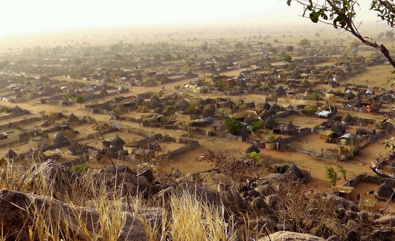
Human Interaction with Geography
The interplay between Darfur’s people and its physical environment is at the core of its ongoing narrative:
- Historical Settlements & Trade Routes: The region’s geography has historically directed the flow of migration, trade, and cultural exchange. Ancient trade routes traversed fertile areas and navigable rivers, embedding geography into Darfur’s cultural memory.
- Traditional Livelihoods: Communities have long relied on the land through agriculture, pastoralism, and artisanal activities. These traditional practices not only reflect a deep understanding of local ecosystems but also drive modern initiatives aimed at sustainable development.
- Modern Adaptations: Facing environmental challenges, local communities are increasingly integrating contemporary techniques—such as efficient irrigation, renewable energy use, and digital mapping—to secure a more resilient future.

Mapping Darfur: A Digital Exploration
At Darfur 2030, we believe that understanding geography is essential for informed decision-making and sustainable progress. Interactive maps, satellite imagery, and digital archives offer visitors a unique, hands-on opportunity to explore:
- Topographical Features: Dive into detailed maps that highlight mountains, deserts, and water systems.
- Climate Data: Explore historical and current climate trends, rainfall variability, and temperature extremes across different regions.
- Resource Distribution: Learn where natural resources are concentrated and see how this shapes local economies and settlement patterns.